Benimuslem is a small Ribera Alta municipality whose identity is closely tied to water. The settlement stands on the left bank of the River Júcar, while its almost entirely flat municipal area belongs to the irrigated plain that defines this part of Valencia province. A useful visit does not require an inflated list of monuments. Its value lies in reading a specific place: La Purísima church as the urban reference point, the quiet streets around it, farmland supplied through the Acequia Real del Júcar and visible memories of flooding. This guide offers a compact, evidence-based route instead of turning ordinary features into invented attractions.
What to see in Benimuslem
La Purísima parish church
The parish church dedicated to the Immaculate Conception is the principal built landmark listed by the Valencia Provincial Council’s tourism service. It is the clearest place to begin, allowing visitors to understand the modest scale of the centre and the way everyday streets meet around the parish. Interior access depends on worship and the church’s actual opening arrangements. If the doors are closed, the exterior still provides a meaningful starting point and avoids making an unverified promise about admission.
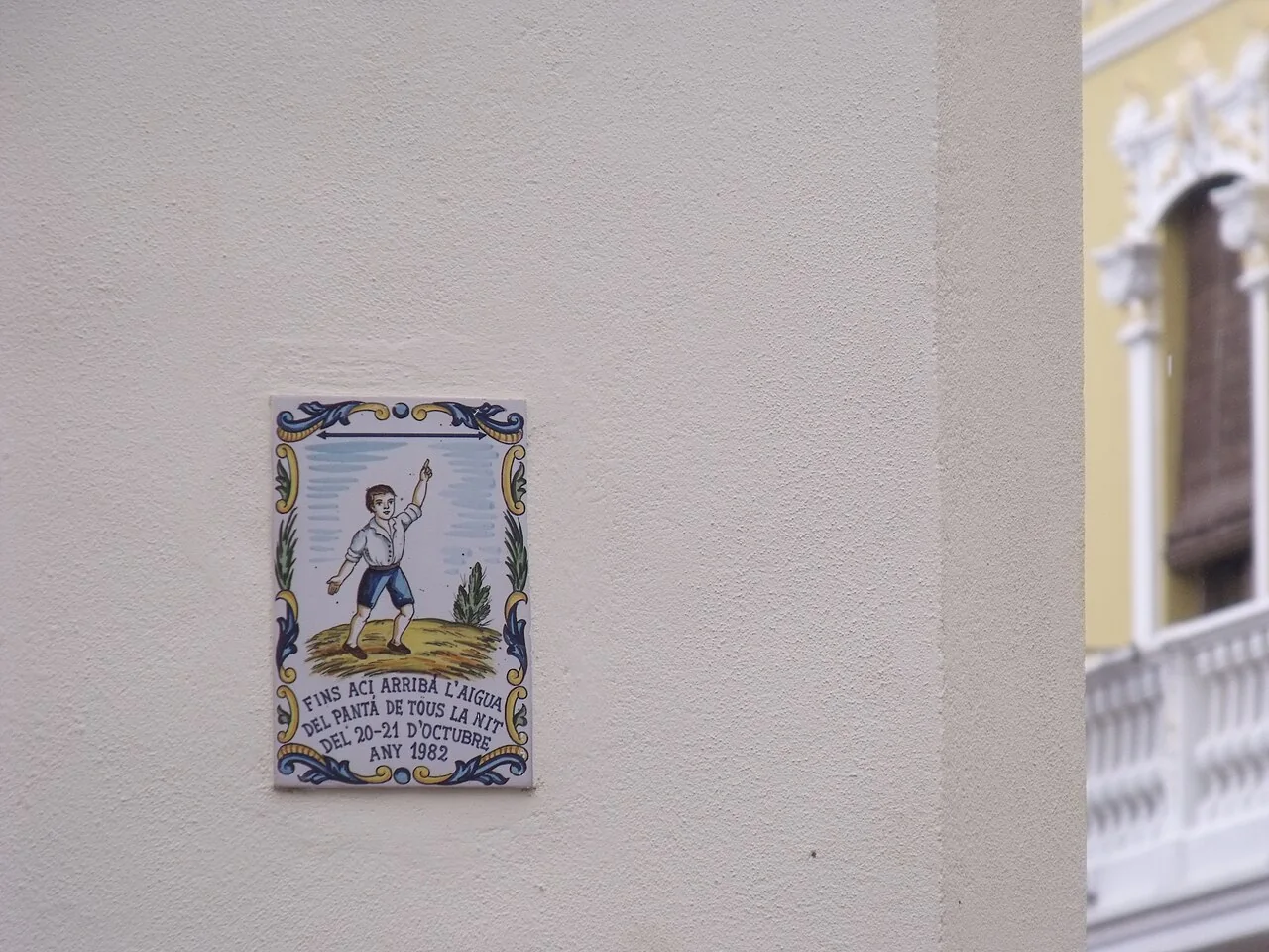
The plaque recording the 1982 flood
The photograph at the top of this page is not a view of a square or a general townscape. It shows a ceramic plaque marking how high the water rose during the night of 20–21 October 1982, in the disaster associated with the Tous dam. Written in Valencian and fixed to a local façade, it turns an ordinary wall into a record of shared memory. It helps explain why living beside the Júcar has involved not only fertile land but also risk, recovery and remembrance. The plaque should be viewed from public space with respect for the building to which it belongs.
The River Júcar landscape
València Turisme identifies the Júcar riverside landscape as Benimuslem’s other main point of interest. The river forms the southern and south-eastern boundary of the municipality, yet this does not mean every farm track is public, safe or passable throughout the year. Ask the council about a suitable access before setting out, and stay away from the banks during heavy rain, high water or agricultural work. The appeal is not a managed visitor attraction but the opportunity to understand the floodplain that has shaped settlement and cultivation.
Irrigated farmland and the Acequia Real
The surrounding farmland completes the picture. The provincial tourism source explains that local irrigation uses Júcar water carried by the Acequia Real and associates the area with citrus fruit, rice, wheat and vegetables. From authorised public routes, visitors can see the pattern of plots, channels and boundaries typical of the Ribera Alta. Fields are workplaces, not open-access parks: do not enter private land, cross gates or describe every irrigation structure as a monument. Observing without interfering is part of visiting responsibly.
A short route that reflects the place
- Begin at La Purísima. Look at the exterior and its immediate setting to understand the centre’s scale.
- Walk through the central streets. Find the flood plaque without entering private property and read it as direct testimony from 1982.
- Approach the agricultural edge. Use public roads only and observe the irrigated landscape from them.
- Finish towards the Júcar. Add this section only when the council confirms a suitable route and weather conditions are stable.
The urban portion fits comfortably into a short morning. Extending the walk towards the river depends more on track conditions than on distance. A longer day can include another Ribera Alta municipality, but Benimuslem deserves to be understood on its own terms rather than treated as an anonymous stop between larger towns.
Food and local calendar
The provincial listing connects Benimuslem with rice dishes including paella, arròs al forn amb fesols i naps and arròs caldós. It also mentions arnadí, Easter monas and sweet-potato pastissets. These are cultural references, not a guarantee that every dish is available locally on every date, so check which businesses are open before planning a meal. Patron saint celebrations take place in August and honour the Immaculate Conception, Saint Roch, Saint Anthony and the Christ of Health. Exact dates and events should always be checked in the current council programme.
Practical advice
- The centre is suitable for walking, while farm tracks may be uneven and provide little shade.
- Carry water and sun protection in summer and avoid the hottest part of the day.
- After intense rain, keep away from riverbanks, underpasses and areas liable to flood.
- La Purísima remains a place of worship; interior access is not guaranteed and services should not be disturbed.
- The photographed plaque is a memorial feature on a façade, not a museum or visitor centre.
Useful questions before visiting
Is there enough for a full day?
The core route is designed for half a day and combines heritage, memory and landscape. Pairing it with a nearby town is more honest than padding the itinerary with unnamed or generic stops.
Can visitors always reach the river?
No. Access and track conditions can change. The council is the appropriate source for confirming a public, safe route at the time of the visit.
What exactly does the main image show?
It is a ceramic plaque recording the level reached by the 1982 flood in Benimuslem. Wikimedia Commons identifies the subject explicitly and provides the photographer and licence details.
Where should opening times and festivities be checked?
Use Benimuslem Town Council and the official València Turisme destination page linked below, ideally shortly before travelling.
Related guides
Official sources and image credit
The editing date records changes to the text, not a new check of opening hours, telephone numbers or accessibility. Specific verification dates, where recorded, appear beside the relevant information.