Sourced guide
Setting and character
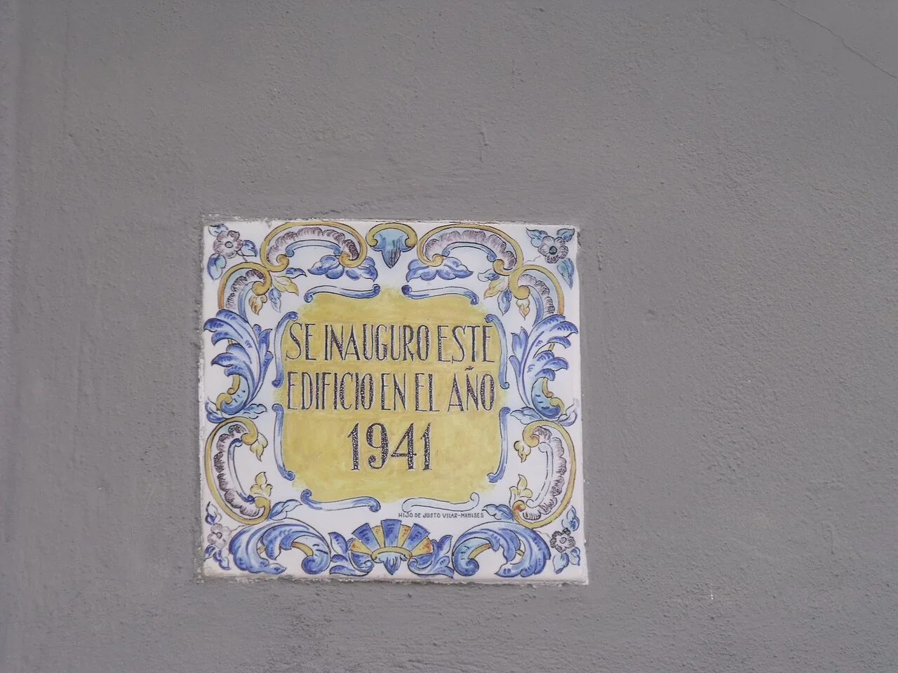
The photograph is a close view of a ceramic plaque reading “Se inauguró este edificio en el año 1941”. It does not independently identify the building or its current use. This guide preserves the visible date without inventing an artist, institution or function unsupported by the image.
Documented heritage
Rotglá y Corbera combines two historic settlements in one municipality. València Turisme lists a parish church and chapel but provides no detailed chronology in this summary. Locate them separately and confirm worship, ownership and access before promising interior admission.
Landscape and territory
The municipality lies on the left bank of the Cànyoles. The river explains the Costera plain, although a geographic mention does not mean a marked walk, swimming or channel access. Avoid low crossings after rain and follow flood warnings.
How to organise the visit
Fuentes de Porta and Sierra Carraposa appear as places of interest. They do not necessarily form one route or share facilities. Check mapping, shade, surface, ownership and wildfire risk, particularly when linking the settlements to outlying land.
Food, boundaries and context
The 1941 plaque supplies a specific fragment of building memory that a generic template would miss. It can join a walk past façades and public spaces without touching it or blocking homes. Rice dishes and sweets depend on businesses and dates and do not replace practical verification.
Responsible planning
When planning a visit to Rotglá y Corbera, check the linked council or tourism page, the weather forecast and any notices about fire risk, works or festivities. Churches are not museums with permanent opening hours, while farms, terraces and houses mentioned may be private. Carry water and suitable footwear, avoid blocking narrow streets and never enter riverbeds, ruins or closed structures. Timing depends on gradient, mobility and stops, so keep the town walk separate from a mountain route or an outlying drive. Record a clear return point as well, and do not depend on an old photograph, an automated map pin or continuous mobile coverage for navigation. If conditions on the ground contradict this guide, always follow recent signs, municipal staff and emergency-service instructions.
How to use this information
For Rotglá y Corbera specifically, the linked sources support the names, dates and features used to explain the municipality, but they do not replace a real-time check. A heritage record may remain historically accurate even when access, signs or the building’s use changes. This guide therefore separates established facts from variable recommendations and does not promise admission, tours, toilets or food service. Where institutions provide different dates, they are treated as phases or the discrepancy is stated instead of being hidden.
When exploring Rotglá y Corbera, accessibility differs greatly between a square, hermitage, viewpoint and trail. Anyone needing step-free routes, adapted public transport or accessible toilets should confirm them with the council before travelling. Bus frequency, taxis and charging points can also vary in small villages. Save useful contact details, download a map before leaving the settlement and allow enough daylight to return. No scenic reference is permission to cross private property or continue in poor weather. Confirm the exact meeting point and return option rather than relying on a photograph, an old timetable or an automatically generated map pin.
Frequently asked questions
How much time should I allow?
For Rotglá y Corbera: Allow roughly one to four hours for the settlement and plan the described routes or outlying sites separately.
Are interiors and natural sites always accessible?
For Rotglá y Corbera: No. Confirm opening times, permission, trail condition and restrictions through official sources before travelling.
How is this different from a generic template?
For Rotglá y Corbera: Every place, date, image and municipal boundary has been checked for this municipality, with the supporting sources linked below.
Related guides and local data
Official sources and verification
The editing date records changes to the text, not a new check of opening hours, telephone numbers or accessibility. Specific verification dates, where recorded, appear beside the relevant information.