Skip to content

València Informada

Practical guides, open data and official sources to better understand Valencia and the Valencian Community.

  • Guides
    • Services
    • Practical guides
  • Health
    • Health-centre directory
  • Mobility
  • Data
    • Open data
    • Municipalities
    • Tourist accommodation
    • DANA
  • Tourism
    • Tourism and culture
    • Municipality guide
  • News
  • ESCAEN
  1. Home
  2. Castellon
  3. Rossell: Sants Joans, Bel and municipal paths
Tourism guide

Rossell: Sants Joans, Bel and municipal paths

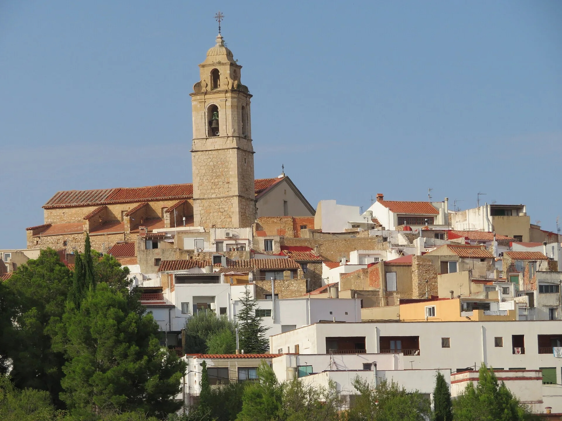
The photograph gives a panorama of Rossell and its setting; Bel and its Romanesque church are outside the frame.

2 September 2024 2 min read Text edited 2 Sep 2026
Rossell
GuideHealthNews
  1. The centre is arranged around Sants Joans
  2. Bel retains two streets and a Romanesque doorway
  3. Paths connect ravines, farmsteads and mills
  4. Related guides and local data
  5. Sources consulted

Panorama of Rossell among farmland and mountains
Panorama of Rossell among farmland and mountains · Juan Emilio Prades Bel · CC BY 4.0

The photograph gives a panorama of Rossell surrounded by farmland and mountain relief. It places the settlement in its landscape but cannot identify every street or building. Bel and Les Cases del Riu do not appear.

The centre is arranged around Sants Joans

The parish church has a Baroque façade with Classical influences and is associated with 18th-century growth. The historic centre forms a concentric pattern around the church on a hilltop, a relationship better understood from the viewpoints than through a generic label.

Bel retains two streets and a Romanesque doorway

Bel, incorporated into Rossell in 1971, retains Carrer Major, Carrer del Sol, small houses and Sant Jaume Church. Its doorway is the clearest Romanesque example in the district. It is a separate settlement reached by road and marked paths.

Paths connect ravines, farmsteads and mills

The council network includes routes through Requena or Bel ravine, Pena de Bel, Camí Vell de la Pobla and mills near Les Cases del Riu. Distances, junctions, weather and ground conditions should be checked against the official maps before setting out.

This documentary edit distinguishes Rossell, Bel and Les Cases del Riu. It does not verify buildings, worship, doorway, homes, roads, paths, ravines, mills, signs, hours, parking or accessibility on site.

Related guides and local data

  • La Salzadella
  • La Pobla de Benifassà
  • San Rafael del Río
  • Municipality guide finder

Sources consulted

  • Ayuntamiento de Rossell — lugares de interés
  • Ayuntamiento de Rossell — Bel
  • Ayuntamiento de Rossell — senderos

Documentary sources consulted on 1 September 2026. This is not an on-site inspection or a full check of opening hours, telephone numbers or accessibility. Any visiting conditions mentioned come from the linked sources.

Share on social media
x facebookwhatsapptelegram
Follow us on social media
x

You may also be interested in

Nearby municipalitiesBenicarlóNearby municipalitiesCàligNearby municipalitiesCanet lo Roig

València Informada editorial team. Published on 2/09/2024 and updated on 2/09/2026.

Informational content based on public sources. València Informada is not an official website and does not replace the competent public administration.

The editing date records changes to the text, not a new check of opening hours, telephone numbers or accessibility. Specific verification dates, where recorded, appear beside the relevant information.

València Informada

Independent citizen portal with practical guides, open data, local news and official sources from Valencia and the Valencian Community.

Guides

Practical guidesArchiveLatest newsContact

Transparency

About usAbout the siteEditorial policySources usedCorrections

Legal

Legal noticePrivacyCookies
©2026 València Informada