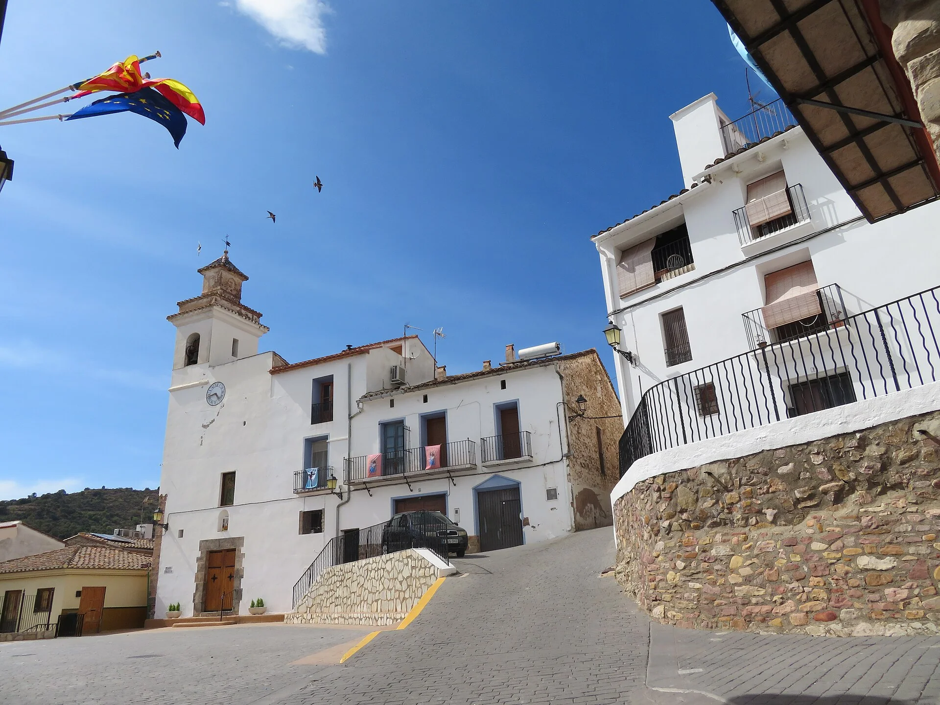
The photograph shows Santa Ana Church in Chóvar’s square. Its clock and bell tower, white façade, homes, balconies and a sloping street fill the frame. Flags and decorations record the moment of the photograph; neither Ajuez reservoir nor the mines is visible.
Santa Ana begins the urban route
The council guide begins its walk in this square and dates the present church to the 18th century, while documenting an earlier project from 1595. The façade retains a niche with a ceramic panel, and the tower stands on the left. The image establishes the exterior, not the interior decoration or a particular celebration.
Ajuez lies outside the centre and its water level varies
The reservoir retains water from the ravine for irrigation and has received extensions and repairs. The council warns that leakage makes a full reservoir uncommon except after heavy rain. A constant body of water should not be promised, and the photographed square is not the reservoir itself.
The mining route does not permit entry underground
The ravine itinerary continues through cork oaks towards Fuente Fresca and the Hembrar mine remains. The local guide identifies spoil, rails, wagons, shafts and furnaces, but says the mine entrance is fenced and entry prohibited because it is dangerous. Heritage must be observed from the authorised route.
This documentary edit corrects the image and separates square, reservoir and mining. It does not verify worship, decorations, clock, water, potability, rain, path, fencing, mines, shafts, rockfall, fire restrictions, signs or accessibility on site.
Related guides and local data
Reading the Ajuez landscape
The official provincial description explains that the Ajuez dam stores water for the nearby orchards and that the track continues into the gorge towards Fuente Fresca. The route therefore connects water management, cultivated land and the mountain environment. Treat it as an outdoor walk: check weather and trail conditions, carry water and do not assume that a mapped spring is suitable for drinking.
Sources consulted
- Ayuntamiento de Chóvar — ruta urbana
- Ayuntamiento de Chóvar — ruta del barranco de Ajuez
- Ayuntamiento de Chóvar — lugares de interés de Ajuez
Documentary sources consulted on 1 September 2026. This is not an on-site inspection or a full check of opening hours, telephone numbers or accessibility. Any visiting conditions mentioned come from the linked sources.
The editing date records changes to the text, not a new check of opening hours, telephone numbers or accessibility. Specific verification dates, where recorded, appear beside the relevant information.