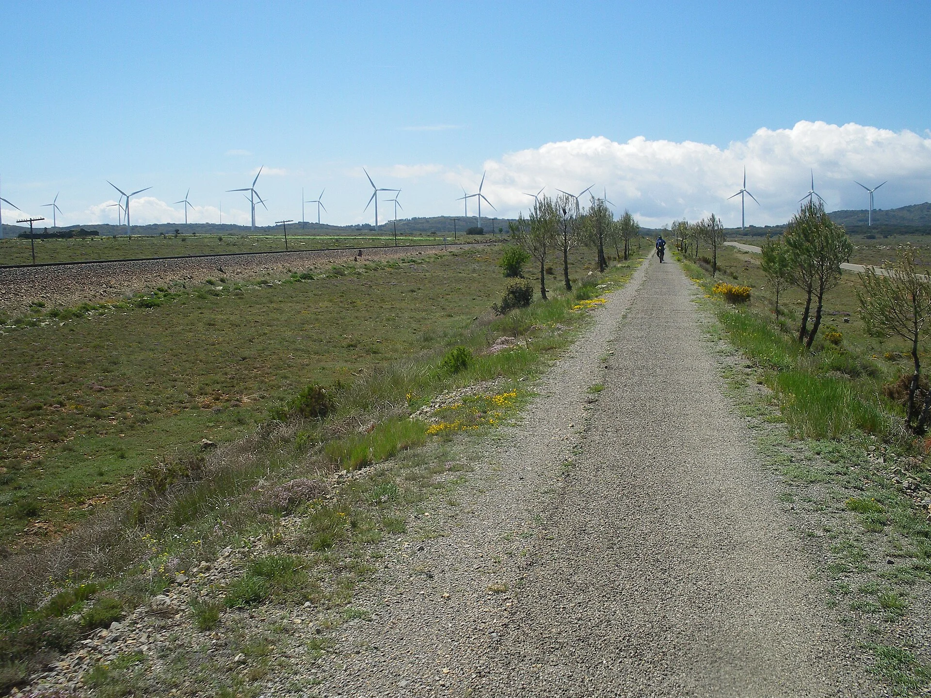
The photograph was taken on the Ojos Negros Greenway as it passes Barracas. A cyclist travels along the earth platform while the working railway and a road run beside it; wind turbines fill the horizon. This is neither a street in the village nor a historical image of the mining train.
The greenway reuses the mining railway
The route follows the former line that carried iron ore from Ojos Negros to Sagunto, opened in 1907. Today’s railway runs parallel at several points, a distinction visible in the photograph: permission to use the cycling platform does not extend to crossing or walking on active tracks.
Barracas is a stop on the plateau
The council guide places the village on the former royal road from Aragón to Valencia and lists San Pedro Church, the 1576 fountain, San Roque hermitage and Palancar station as separate references. The greenway explains the photograph’s linear landscape, but does not replace a visit to the village or identify every railway building by itself.
Camino del Cid is not another name for the greenway
Barracas also appears on Camino del Cid’s Conquest of Valencia route, which has its own itineraries and travel modes. It may share territory with the greenway, but walkers and cyclists should use the appropriate current official road, cycling or hiking track. Ojos Negros conditions and signs should not automatically be assumed to apply to Camino del Cid.
This documentary edit distinguishes cycling platform, active railway, road and historical route. It does not verify trains, crossings, surfaces, works, wind, snow, lighting, fountains, station, tracks, services, signs or accessibility on site.
Related guides and local data
A high-plateau stop
The Provincial Council places Barracas at about 981 metres above sea level, on a plateau between the Pina de Montalgrao and Javalambre ranges. That elevation explains why conditions can differ sharply from the coast, particularly in winter. Check the forecast before using the Ojos Negros Greenway, take an extra layer and plan the return: the route follows a former railway and a casual walk can easily become longer than expected.
Sources consulted
- Ayuntamiento de Barracas — guía de la Vía Verde de Ojos Negros
- Turisme Comunitat Valenciana — Vía Verde de Ojos Negros
- Camino del Cid — La Conquista de Valencia en bicicleta
Documentary sources consulted on 1 September 2026. This is not an on-site inspection or a full check of opening hours, telephone numbers or accessibility. Any visiting conditions mentioned come from the linked sources.
The editing date records changes to the text, not a new check of opening hours, telephone numbers or accessibility. Specific verification dates, where recorded, appear beside the relevant information.