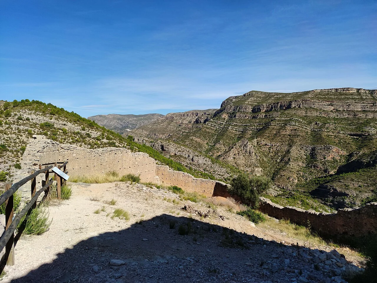
Millares occupies rugged territory in La Canal de Navarrés, shaped by the Júcar and the Caroig massif. Its attractions have specific names and substance: Castillet, Cavas castle, Transfiguration church, rock-art shelters, Cueva de las Donas and the Tambuc dinosaur tracks. They do not form a single urban route. Some are distant and require permission, a guide or mountain planning, so this guide clearly separates the village walk from outdoor excursions.
What to see in Millares village
Transfiguration parish church
The Valencian tourism authority identifies the Transfiguration church as the principal religious building and describes it as Baroque. Its exterior can always be included in a walk. Interior access depends on worship and occasional openings; confirm availability and never disrupt a service.
Palace of the Territorial Lord
The former palace provides the civic reference on the urban route. It must not be advertised as a museum or assumed to have public interior access. From public space it helps explain the historic organisation of the village and connects with the church, fountains and washhouses.
Fountains, washhouses and water
The official gallery names the Hinchidor fountain and pool, El Clot washhouse, Fuente de las Donas and Fuente de los Escalones. These are specific references, not generic “water heritage”. Their condition and flow vary: do not drink without a health notice, enter pools or cross closed areas. Waterfalls and the Barranco del Nacimiento also require checks on rain, flow and ground conditions.
Castillet or Lower Castle
The photograph shows Castillet ruins above the Júcar gorge. València Turisme reports that the wall circuit survives, although sections and interior structures are damaged or buried. Excavated pottery indicates stable occupation from the late twelfth to early thirteenth century, during the final Islamic period before Christian conquest. The ruins are not an urban park: expect slopes, uneven ground and fall risk. Follow signed access and never climb on walls.
Cavas castle
Farther away, Cavas castle retains ruins and a watchtower on high ground above the Júcar upstream. It is a separate fortress and must not be confused with the Castillet in the image. Any approach requires mapping, time and local confirmation of the route.
Rock art and Cueva de las Donas
Millares belongs to the Mediterranean rock-art territory protected by UNESCO. The regional authority highlights Chorradores and Vicent shelters: the former preserves a honey-gathering scene and the latter hunting scenes in Tambuc ravine. Cueva de las Donas contains evidence of different prehistoric occupations. Their fragility rules out casual cave tourism. Enter only when a visit is authorised and, where required, booked or guided. Never touch paintings, walls or sediment.
Tambuc dinosaur tracks
Tambuc East and West lie in the Rambla del Tambuc, about 17 kilometres south of the village according to the official listing. The rocky bed preserves footprints and forms part of the Dinosaur Trails network. This is not an improvised final stop: road or track travel, heat and flash-flood risk require a separate plan. Never enter a rambla during rain or a weather alert.
Realistic ways to visit
- Short visit: church, former palace, fountains and washhouses, followed by a safe village viewpoint over the relief.
- Heritage outing: either Castillet or one confirmed prehistoric site, not every location in one morning.
- Palaeontology day: José Martínez Royo museum collection and Tambuc only after checking opening, access and rambla conditions.
Festivals, food and safety
Official sources list Sant Blai on 3 February, Sant Joan on 24 June and Cristo de la Salud in August, alongside esparto craft. Food includes gachas, gazpacho-style dishes, cured meats and mojete. Dates and availability change, so check before travelling. Millares requires suitable footwear, water and sun protection. Around ravines, castles and caves, visual proximity never means easy access: turn back when signs, permission or reliable coverage are missing.
Mobile coverage, shade and drinking water cannot be assumed outside the village. Tell someone which route you plan to follow, download mapping in advance and leave enough daylight for the return. Heritage protection takes priority over completing an itinerary: a closed gate or restricted shelter is a firm endpoint, not an obstacle to bypass.
Related guides and data
Official sources and checks
The editing date records changes to the text, not a new check of opening hours, telephone numbers or accessibility. Specific verification dates, where recorded, appear beside the relevant information.