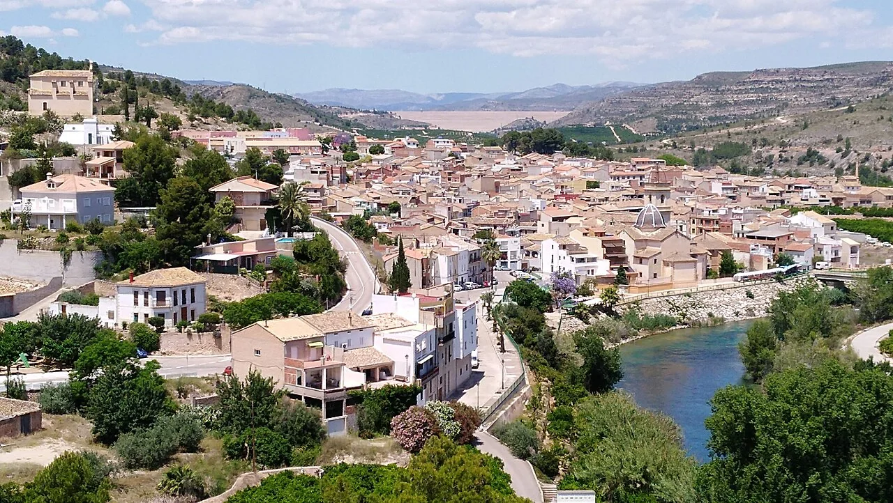
Sumacárcel stands on a terrace above the Júcar River, at the foot of the hills separating La Ribera Alta from the Canal de Navarrés district. Its setting explains the stepped shape of the village, its viewpoints, historic paths and close relationship with water. A coherent visit begins in the centre, climbs towards the Calvary and palace, and saves the coolest part of the day for the river or one walking trail.
What to see in Sumacárcel
Church of Sant Antoni Abat and the village walk
The parish church of Sant Antoni Abat is the main monument in the centre. València Turisme dates its construction to 1723–1750 and highlights the Chapel of Christ and the crypt connected with the Counts of Orgaz and Sumacárcel. Even an exterior visit helps explain how the large church fits into streets built on a slope. The official tourism portal also suggests an easy urban circuit of about 2.5 kilometres taking in the old public washhouse, traditional homes and the Calvary. Church interiors may be closed outside services, so check access and visit respectfully.
Palace of the Counts of Orgaz
The palace adds the civil side of local history. The provincial tourism authority describes it as a rural noble residence with late-medieval origins, developed around the 15th century. Its value is easier to understand when viewed in relation to the surrounding streets and the former seigneurial structure of the town. Opening arrangements can change; this guide does not assume that the interior is accessible.
Calvary, viewpoint and chapel
The climb to the Calvary provides a clear view across the roofs, the Júcar and the cultivated valley. It is a useful place for understanding why Sumacárcel developed between river and mountain. The gradient and surface can be uncomfortable in high heat or after rain. Grippy footwear, drinking water and an unhurried pace matter more than completing a fixed checklist.
Penya-roja Castle and walking trails
The remains of Penya-roja Castle overlook the valley route. This is an archaeological and landscape site reached on foot, not a staffed museum. València Turisme describes a circular walk from Font del Viró of roughly 5.5 kilometres, low difficulty and an indicative duration of 3 hours 15 minutes. It first follows the river and continues through La Vedà and Ombria del Castell near the ruins. Use those figures for planning, not as a guarantee: trail condition, river level, weather and wildfire restrictions can change.
Shorter alternatives include Camí de la Costa and Senda de la Tosca. The former was once a communication route towards Canal de Navarrés and quickly gains open views. Senda de la Tosca follows an old water channel; official information describes the first two thirds as gentle and the final part as irregular and steep. Neither should be presented as a universally accessible town stroll. Choose according to fitness, temperature and remaining daylight.
The Júcar and L’Esgoletja
L’Esgoletja island is the best-known recreation area beside the river, with picnic and play space according to the regional tourism portal. It provides a close view of the riverside landscape, but it requires caution. An official tourism reference to bathing does not guarantee that entering the water is permitted or safe on the day: current flow, water quality, currents and local restrictions must be checked. Take all rubbish away and respect any temporary closure.
A practical half-day route
- Village centre: see the church of Sant Antoni Abat, the washhouse and traditional streets.
- Civil heritage: continue to the Counts’ Palace and consider the surrounding urban fabric as part of the site.
- Viewpoint: climb to the Calvary only if heat and mobility allow.
- Final choice: stop at L’Esgoletja or follow one marked trail. Trying to combine every path in one morning makes for a rushed and less safe visit.
Practical advice and local food
In summer, walk early and leave the compact centre until later. Carry water and sun protection, and do not rely solely on mobile coverage. Heavy rain can affect ravines and paths near the river. For food, the provincial source identifies orelletes, a light fried pastry, as a local speciality. Restaurant availability and hours vary, so verify what is open rather than planning around an unconfirmed service.
Related guides
Official sources consulted
- Comunitat Valenciana Tourism — Sumacárcel
- València Turisme — Sumacàrcer
- València Turisme — Penya-roja and the Vedà trail
- INE — official municipality register
Editorially reviewed on 22 July 2026. Opening arrangements, access and natural conditions can change; confirm operational details with the official sources before travelling.
The editing date records changes to the text, not a new check of opening hours, telephone numbers or accessibility. Specific verification dates, where recorded, appear beside the relevant information.