Sourced guide
Setting and character
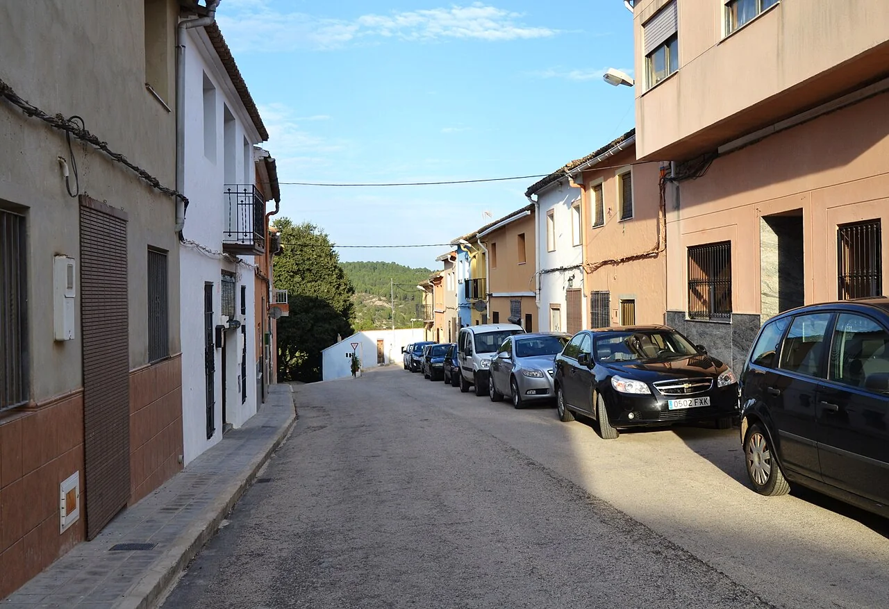
Estubeny overlooks the valley cut by the Sellent from a small, stepped settlement. The featured photograph is Carrer de Sant Antoni: it shows homes, a sloping street and woodland beyond, not a monumental “historic centre”. This everyday scale is the right introduction to a municipality where built heritage and the exceptional humidity of Selva de Estubeny belong to the same visit.
Documented heritage
Sant Onofre church was rebuilt after the 1748 earthquake and retains a detached bell tower. The provincial tourism authority documents a small Baroque figure of the saint dated 1643 on the main altar and a 1795 Neoclassical chapel housing Our Lady of Sorrows by Josep Esteve Bonet. Interior access depends on worship; the washhouse and nearby streets complete a route through reliably public spaces.
Landscape and territory
Selva de Estubeny, also known as Cabrentà, is a protected Municipal Natural Landscape with a particularly humid microclimate supplied by groundwater from the Caroig massif. Springs and small cascades have formed calcareous deposits visible without entering a cave. It is not an urban park: stay on the permitted route, do not touch formations, wear slip-resistant shoes and check closures after rain or maintenance.
How to organise the visit
Half a day can connect Sant Onofre, the washhouse, a viewpoint over the Sellent and the authorised nature trail. Umbría, Taberneta and other places require a route check and more time. The provincial guide links Estubeny with Cassoleta, a baked-rice celebration, and names sweet-potato pastries, coca en llanda and arnadí. These are cultural references; travellers should ask when and where they are actually available.
Food, boundaries and context
Nearby Anna’s lake does not belong to Estubeny and should only be proposed as a clearly separate stop. Wet weather can leave mud and slippery surfaces, while hot days still require drinking water despite the lush setting. Narrow village streets should not be blocked by careless parking. A responsible visit combines support for local businesses with quiet behaviour and care inside the protected landscape.
Responsible planning
When planning a visit to Estubeny, check the linked council or tourism page, the weather forecast and any notices about fire risk, works or festivities. Churches are not museums with permanent opening hours, while farms, terraces and houses mentioned may be private. Carry water and suitable footwear, avoid blocking narrow streets and never enter riverbeds, ruins or closed structures. Timing depends on gradient, mobility and stops, so keep the town walk separate from a mountain route or an outlying drive.
How to use this information
For Estubeny specifically, the linked sources support the names, dates and features used to explain the municipality, but they do not replace a real-time check. A heritage record may remain historically accurate even when access, signs or the building’s use changes. This guide therefore separates established facts from variable recommendations and does not promise admission, tours, toilets or food service. Where institutions provide different dates, they are treated as phases or the discrepancy is stated instead of being hidden.
When exploring Estubeny, accessibility differs greatly between a square, hermitage, viewpoint and trail. Anyone needing step-free routes, adapted public transport or accessible toilets should confirm them with the council before travelling. Bus frequency, taxis and charging points can also vary in small villages. Save useful contact details, download a map before leaving the settlement and allow enough daylight to return. No scenic reference is permission to cross private property or continue in poor weather.
Frequently asked questions
How much time should I allow?
For Estubeny: Allow roughly one to four hours for the settlement and plan the described routes or outlying sites separately.
Are interiors and natural sites always accessible?
For Estubeny: No. Confirm opening times, permission, trail condition and restrictions through official sources before travelling.
How is this different from a generic template?
For Estubeny: Every place, date, image and municipal boundary has been checked for this municipality, with the supporting sources linked below.
Related guides and local data
Official sources and verification
The editing date records changes to the text, not a new check of opening hours, telephone numbers or accessibility. Specific verification dates, where recorded, appear beside the relevant information.