A visit with context
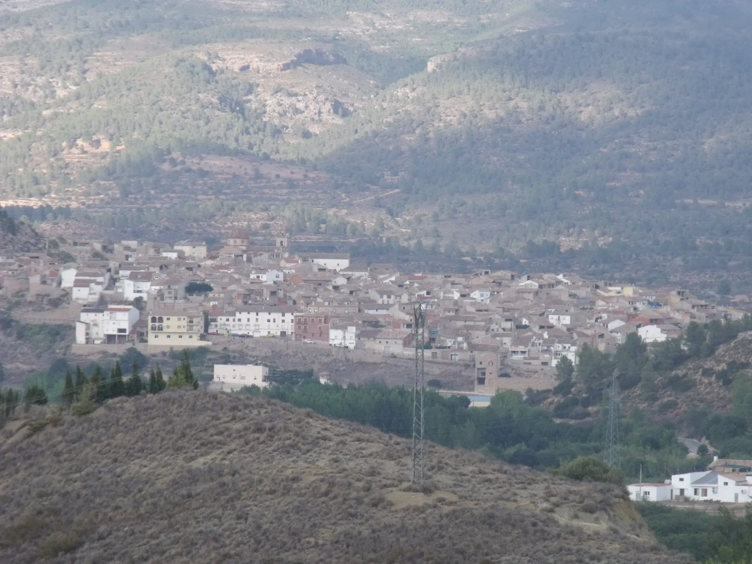
Teresa de Cofrentes occupies a landscape of wooded slopes and ravines associated with the Caroig massif. The Reconque receives the Zarra and forms the Cantabán, while high plateaux and forest define much of the municipal area. The replacement featured image, photographed from Zarra, finally shows the town, church tower and surrounding relief; it replaces an uninformative bench photograph without deleting the earlier media file.
Heritage and history
Asunción church is the main landmark in the centre. The provincial authority says it was substantially altered in the nineteenth century, although its underlying structure may be older. It has three naves, barrel vaults and a dome raised on a drum and pendentives, with the tower integrated into the plan. This careful description avoids assigning a precise construction date that the source itself does not confirm.
San Apolinar hermitage was blessed on 3 February 1702 and is now associated with access to the cemetery. It has a single nave, buttresses, a barrel vault and a bell gable. Ruined traces of the Palaz tower or castle also survive. Local tourism tradition proposes very early origins for the fortification, but a responsible guide presents this as a local account rather than converting an unverified chronology into archaeological fact.
Landscape and route
Parts of the municipality relate to protected areas including Valle de Ayora–Sierra del Boquerón and Sierra de Martés–Muela de Cortes. Any countryside trip requires checks for fire risk, weather, hunting, signs and mobile coverage; not every track is a visitor trail. A town walk can link the church and upper streets, add San Apolinar and leave the mountains for another day. Gachamiga, covered soup, poor-man’s potatoes, meatballs and gazpacho-style dishes appear in the provincial food list, subject to availability.
Responsible planning
This guide gives priority to municipal, provincial and regional-government sources. Its links let readers verify the original evidence and identify later changes. Use a current map for the journey and check transport on the day of travel: services to small municipalities can be infrequent, while an old timetable is not proof that a bus or facility still operates.
Distances should be adjusted for mobility, age and temperature. Sloping streets, uneven surfaces and buildings without continuous access can change a route substantially. Anyone requiring step-free access should ask the council or venue a specific question, because describing two places as close does not mean there are no steps. Respect for homes, crops, worship, local events and signs is part of a visit that benefits the community.
Related guides and data
Official sources and checks
The editing date records changes to the text, not a new check of opening hours, telephone numbers or accessibility. Specific verification dates, where recorded, appear beside the relevant information.