Sourced guide
Setting and character
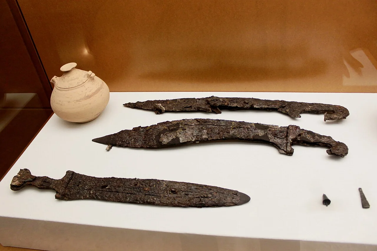
The photograph is not a view of Zarra. It shows a display containing an urn, two falcatas, a sword and small objects from Las Peñas according to the Wikimedia record. These are archaeological finds rather than decorations. Their current display location must be checked; the image grants no excavation or site access.
Documented heritage
València Turisme lists the Iberian cemetery with the town, Renaissance church, tower dated 1880, 1905 square and Panoja fountain, and 1920 washhouse. Each feature needs its own location and context. Their different dates must not be compressed into a single invented historical phase.
Landscape and territory
La Hoz, the River Zarra, Rentón and Comuneros dams, caves and springs form a varied outlying territory. Caves, channels and dams have different hazards and access rules. A tourism list does not guarantee open trails or safe swimming; obtain current mapping and heed weather and water management.
How to organise the visit
Hackberry workshops making forks, sticks and handles explain a craft connected with the valley. Do not promise daily demonstrations or enter workshops without arrangements. Cherries, cured meat and local products depend on season and retailers; verify sale and origin before recommending them.
Food, boundaries and context
A balanced visit can link square, church, tower and washhouse, leaving the archaeological site and natural places for separate planning. The photographed archaeology needs context and respect, not treasure language. Gazpacho manchego, gachamiga and toñas show inland influence but are not guaranteed on every date. Anyone interested in the displayed weapons and urn should ask the council or tourism office where the collection can currently be seen instead of assuming that the photographed case is permanently accessible. Museum displays may also rotate or be loaned.
Responsible planning
When planning a visit to Zarra, check the linked council or tourism page, the weather forecast and any notices about fire risk, works or festivities. Churches are not museums with permanent opening hours, while farms, terraces and houses mentioned may be private. Carry water and suitable footwear, avoid blocking narrow streets and never enter riverbeds, ruins or closed structures. Timing depends on gradient, mobility and stops, so keep the town walk separate from a mountain route or an outlying drive.
How to use this information
For Zarra specifically, the linked sources support the names, dates and features used to explain the municipality, but they do not replace a real-time check. A heritage record may remain historically accurate even when access, signs or the building’s use changes. This guide therefore separates established facts from variable recommendations and does not promise admission, tours, toilets or food service. Where institutions provide different dates, they are treated as phases or the discrepancy is stated instead of being hidden.
When exploring Zarra, accessibility differs greatly between a square, hermitage, viewpoint and trail. Anyone needing step-free routes, adapted public transport or accessible toilets should confirm them with the council before travelling. Bus frequency, taxis and charging points can also vary in small villages. Save useful contact details, download a map before leaving the settlement and allow enough daylight to return. No scenic reference is permission to cross private property or continue in poor weather.
Frequently asked questions
How much time should I allow?
For Zarra: Allow roughly one to four hours for the settlement and plan the described routes or outlying sites separately.
Are interiors and natural sites always accessible?
For Zarra: No. Confirm opening times, permission, trail condition and restrictions through official sources before travelling.
How is this different from a generic template?
For Zarra: Every place, date, image and municipal boundary has been checked for this municipality, with the supporting sources linked below.
Related guides and local data
Official sources and verification
The editing date records changes to the text, not a new check of opening hours, telephone numbers or accessibility. Specific verification dates, where recorded, appear beside the relevant information.