Sourced guide
Setting and character
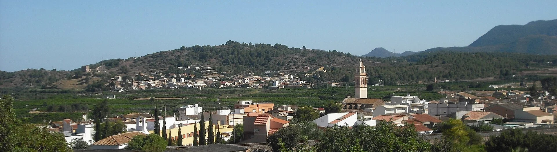
The featured panorama shows Algímia d’Alfara, Sant Vicent’s bell tower, orange groves and Calderona slopes. It is more accurate than the inherited generic alt and explains the transition between the Palancia valley, irrigated farming and mountain. The settlement stands on the river’s right side below Picaio de la Seca and Picaio de la Punta.
Documented heritage
Font del Comte is the best-documented natural and heritage place. Finds nearby include a late-Roman villa from the fourth and fifth centuries, ceramics from later phases and a circular irrigation basin of Muslim origin. These are archaeological traces in a water landscape, not a visitor-ready Roman city. The council has restored native planting and traditional habitat and irrigation structures around the spring.
Landscape and territory
Water from the spring was channelled to the town on 13 July 1907. The first fountain built was in Plaça del Forn, and five town fountains now receive that supply according to València Turisme. An interpretive route can connect spring and settlement, but visitors should never enter tanks or channels and must check whether the forest road to Font del Comte is currently open.
How to organise the visit
Ojos Negros Greenway follows the former Sierra Menera mining railway through a mosaic changing from citrus, olives, almonds and carob to more continental landscapes. Although developed for recreation, tunnels, works and pedestrian–cycle sharing require a current check. Font del Comte, Peña Blanca or La Mina need different planning, drinking water and a fire-risk review rather than being bundled into one casual walk.
Food, boundaries and context
The provincial food account names paella, festive calderas, sardine flatbreads, tomato pastries, panquemados and sweet or savoury tray-baked coca. Ask what is actually available. Torres Torres and Alfara de la Baronia extend a Baronía route; Segorbe or Sagunto are separate stages. The station, paths and fountains make a useful visit without borrowing monuments from neighbouring towns.
Responsible planning
When planning a visit to Algimia de Alfara (Algímia d’Alfara), check the linked council or tourism page, the weather forecast and any notices about fire risk, works or festivities. Churches are not museums with permanent opening hours, while farms, terraces and houses mentioned may be private. Carry water and suitable footwear, avoid blocking narrow streets and never enter riverbeds, ruins or closed structures. Timing depends on gradient, mobility and stops, so keep the town walk separate from a mountain route or an outlying drive.
How to use this information
For Algimia de Alfara (Algímia d’Alfara) specifically, the linked sources support the names, dates and features used to explain the municipality, but they do not replace a real-time check. A heritage record may remain historically accurate even when access, signs or the building’s use changes. This guide therefore separates established facts from variable recommendations and does not promise admission, tours, toilets or food service. Where institutions provide different dates, they are treated as phases or the discrepancy is stated instead of being hidden.
When exploring Algimia de Alfara (Algímia d’Alfara), accessibility differs greatly between a square, hermitage, viewpoint and trail. Anyone needing step-free routes, adapted public transport or accessible toilets should confirm them with the council before travelling. Bus frequency, taxis and charging points can also vary in small villages. Save useful contact details, download a map before leaving the settlement and allow enough daylight to return. No scenic reference is permission to cross private property or continue in poor weather.
Frequently asked questions
How much time should I allow?
For Algimia de Alfara (Algímia d’Alfara): Allow roughly one to four hours for the settlement and plan the described routes or outlying sites separately.
Are interiors and natural sites always accessible?
For Algimia de Alfara (Algímia d’Alfara): No. Confirm opening times, permission, trail condition and restrictions through official sources before travelling.
How is this different from a generic template?
For Algimia de Alfara (Algímia d’Alfara): Every place, date, image and municipal boundary has been checked for this municipality, with the supporting sources linked below.
Related guides and local data
Official sources and verification
The editing date records changes to the text, not a new check of opening hours, telephone numbers or accessibility. Specific verification dates, where recorded, appear beside the relevant information.